 vesseltracker.com
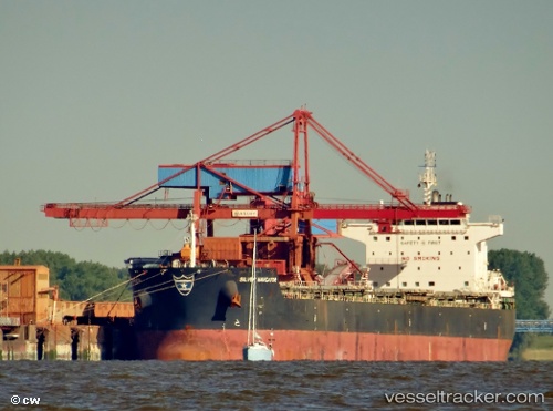
 THEOTOKOS S
Current Status
Where is the vessel?
THEOTOKOS S is currently in 64 nm S of Wanshan Pt, based on AIS data received less than 1h ago.
Latest AIS update:
Current position: 20.86333° N, 113.67667° E (64 nm S of Wanshan Pt)
Average speed (last 7 days): Loading…
Average speed (last 30 days): Loading…
Vessel profile: THEOTOKOS S is a Bulk Carrier with dimensions 229m x 32m.
This page combines live AIS, route history, probable destination signals, nearby traffic, and port activity for practical vessel monitoring.
The current position of vessel THEOTOKOS S is 20.86333 lat / 113.67667 lng. Updated: 2026-05-17 13:27:23 UTCNearest reference points:
- 60 nm SE of Shadi
- 50 nm S of Wanshan Pt
- 78 nm SW of Xijiang
Currently sailing under the flag of MARSHALL ISLANDS ![]()
Details:
Live Vessel THEOTOKOS S Analytics (details, animations, etc.)
Recent AIS points (UTC):
2026-05-17 09:06:24 UTC · 20.14167, 113.59833 · SOG 9 kn · COG -1°2026-05-17 10:03:26 UTC · 20.29833, 113.60833 · SOG 9 kn · COG -1°
2026-05-17 11:45:25 UTC · 20.58500, 113.63333 · SOG 10 kn · COG -1°
2026-05-17 13:27:23 UTC · 20.86333, 113.67667 · SOG 9 kn · COG -1°