 vesseltracker.com
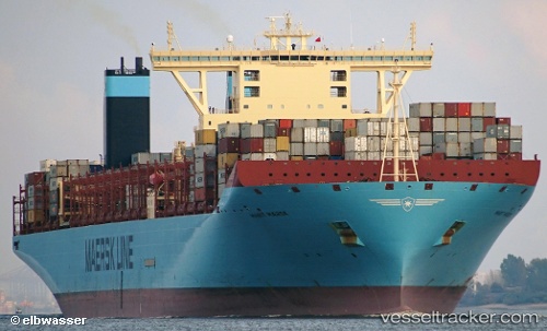
Marit Maersk
Current StatusWhere is the vessel?
Marit Maersk is currently in 130 nm SE of Ramsgate, based on AIS data received less than 1h ago.
Latest AIS update:
Current position: 32.15160° S, 32.39477° E (130 nm SE of Ramsgate)
Average speed (last 7 days): Loading…
Average speed (last 30 days): Loading…
Vessel profile: Marit Maersk is a Container Ship with dimensions 60m x 399m.
This page combines live AIS, route history, probable destination signals, nearby traffic, and port activity for practical vessel monitoring.
The current position of vessel Marit Maersk is -32.15160 lat / 32.39477 lng. Updated: 2026-05-17 23:05:42 UTCNearest reference points:
- 125 nm SE of Port Edward
- 181 nm SE of Hibberdene
- 23 nm E of Port Saint John's
Details:
Live Vessel Marit Maersk Analytics (details, animations, etc.)
Recent AIS points (UTC):
2026-05-17 19:01:38 UTC · -32.65667, 31.19500 · SOG 17 kn · COG -1°2026-05-17 19:30:04 UTC · -32.59737, 31.33478 · SOG 16.4 kn · COG 60°
2026-05-17 21:53:35 UTC · -32.30282, 32.03047 · SOG 17.1 kn · COG 59°
2026-05-17 23:05:42 UTC · -32.15160, 32.39477 · SOG 17.5 kn · COG 59°