 vesseltracker.com
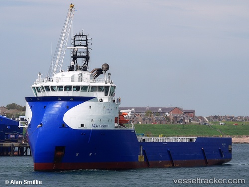
 FORTH TIDE
Current Status
Where is the vessel?
FORTH TIDE is currently in Near Thistle Field, based on AIS data received less than 1h ago.
Latest AIS update:
Current position: 61.38081° N, 1.57927° E (Near Thistle Field)
Average speed (last 7 days): Loading…
Average speed (last 30 days): Loading…
Vessel profile: FORTH TIDE is a Offshore Supply Ship with dimensions m x m.
This page combines live AIS, route history, probable destination signals, nearby traffic, and port activity for practical vessel monitoring.
The current position of vessel FORTH TIDE is 61.38081 lat / 1.57927 lng. Updated: 2026-05-17 03:45:26 UTCNearest reference points:
- 10 nm N of Leadon
Currently sailing under the flag of Norway ![]()
Details:
Live Vessel FORTH TIDE Analytics (details, animations, etc.)
Recent AIS points (UTC):
2026-05-17 00:12:42 UTC · 61.36283, 1.57992 · SOG 0.3 kn · COG 123°2026-05-17 01:49:44 UTC · 61.35996, 1.59145 · SOG 4.9 kn · COG 124°
2026-05-17 01:49:46 UTC · 61.35990, 1.59164 · SOG 4.9 kn · COG 124°
2026-05-17 03:45:26 UTC · 61.38081, 1.57927 · SOG 1 kn · COG 171°