 vesseltracker.com
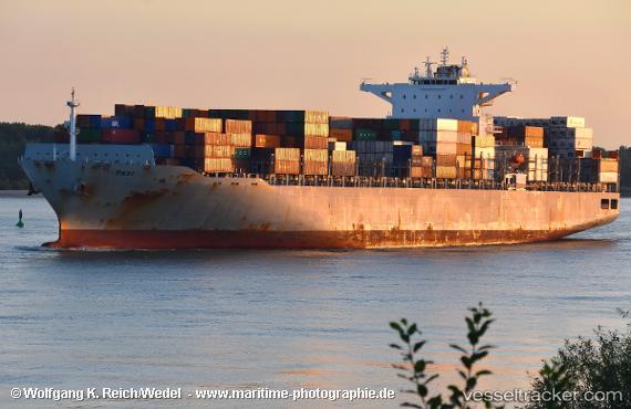
 SFL HAWAII
Current Status
Where is the vessel?
SFL HAWAII is currently in Near Eling, based on AIS data received about 1h ago.
Latest AIS update:
Current position: 50.90953° N, 1.46419° W (Near Eling)
Average speed (last 7 days): Loading…
Average speed (last 30 days): Loading…
Vessel profile: SFL HAWAII is a Container Ship with dimensions 271m x 42m.
This page combines live AIS, route history, probable destination signals, nearby traffic, and port activity for practical vessel monitoring.
The current position of vessel SFL HAWAII is 50.90953 lat / -1.46419 lng. Updated: 2026-05-17 19:49:42 UTCNearest reference points:
- Near Southampton
- Near MERCURY
- Near PORT HAMBLE
Currently sailing under the flag of Liberia ![]()
SFL HAWAII built in 2014 year
Deadweight:
80087 tDetails:
Live Vessel SFL HAWAII Analytics (details, animations, etc.)
Recent AIS points (UTC):
2026-05-17 16:22:42 UTC · 50.90952, -1.46419 · SOG 0.3 kn · COG 304°2026-05-17 17:43:42 UTC · 50.90951, -1.46414 · SOG 0 kn · COG 304°
2026-05-17 19:37:43 UTC · 50.90952, -1.46419 · SOG 0 kn · COG 304°
2026-05-17 19:49:42 UTC · 50.90953, -1.46419 · SOG 0.1 kn · COG 304°