 vesseltracker.com
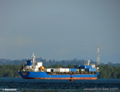
 Tanto Manis
Current Status
Where is the vessel?
Tanto Manis is currently in Near SIBOLGA, based on AIS data received about 1h ago.
Latest AIS update:
Current position: 1.72667° N, 98.78500° E (Near SIBOLGA)
Average speed (last 7 days): Loading…
Average speed (last 30 days): Loading…
Vessel profile: Tanto Manis is a Container Ship with dimensions 120m x 24m.
This page combines live AIS, route history, probable destination signals, nearby traffic, and port activity for practical vessel monitoring.
The current position of vessel Tanto Manis is 1.72667 lat / 98.78500 lng. Updated: 2026-05-17 10:35:39 UTCNearest reference points:
- Near Belawan
- 10 nm NE of Belawan
- 21 nm SW of Pulau Indah
Currently sailing under the flag of Indonesia ![]()
Details:
Live Vessel Tanto Manis Analytics (details, animations, etc.)
Recent AIS points (UTC):
2026-05-17 06:38:34 UTC · 1.41500, 98.70167 · SOG 9 kn · COG -1°2026-05-17 06:38:34 UTC · 1.41500, 98.70167 · SOG 9 kn · COG -1°
2026-05-17 09:32:38 UTC · 1.72500, 98.78667 · SOG 1 kn · COG -1°
2026-05-17 10:35:39 UTC · 1.72667, 98.78500 · SOG 0 kn · COG -1°