 vesseltracker.com
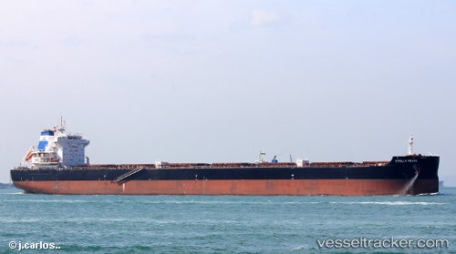
 MANDARIN KAOHSIUNG
Current Status
Where is the vessel?
MANDARIN KAOHSIUNG is currently in 13 nm E of Itapoá, based on AIS data received less than 1h ago.
Latest AIS update:
Current position: 26.14526° S, 48.35530° W (13 nm E of Itapoá)
Average speed (last 7 days): Loading…
Average speed (last 30 days): Loading…
Vessel profile: MANDARIN KAOHSIUNG is a Cargo with dimensions m x m.
This page combines live AIS, route history, probable destination signals, nearby traffic, and port activity for practical vessel monitoring.
The current position of vessel MANDARIN KAOHSIUNG is -26.14526 lat / -48.35530 lng. Updated: 2026-05-17 17:33:40 UTCNearest reference points:
- 24 nm E of Caioba
- 32 nm E of Caioba
- 10 nm NE of CAMBORIU
Currently sailing under the flag of Marshall Islands ![]()
Details:
Live Vessel MANDARIN KAOHSIUNG Analytics (details, animations, etc.)
Recent AIS points (UTC):
2026-05-17 13:51:40 UTC · -26.14504, -48.35456 · SOG 0.1 kn · COG 177°2026-05-17 16:00:35 UTC · -26.14513, -48.35516 · SOG 0.1 kn · COG 166°
2026-05-17 17:06:35 UTC · -26.14515, -48.35507 · SOG 0.1 kn · COG 162°
2026-05-17 17:33:40 UTC · -26.14526, -48.35530 · SOG 0.2 kn · COG 160°