 vesseltracker.com
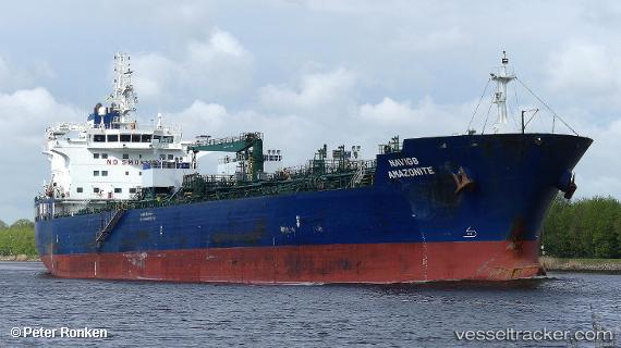
 Navig8 Amazonite
Current Status
Where is the vessel?
Navig8 Amazonite is currently in Open sea (no nearby ports in database), based on AIS data received about 1h ago.
Latest AIS update:
Current position: 32.94143° N, 163.12389° E (Open sea (no nearby ports in database))
Average speed (last 7 days): Loading…
Average speed (last 30 days): Loading…
Vessel profile: Navig8 Amazonite is a Chemical Oil Products Tanker with dimensions 184m x 27m.
This page combines live AIS, route history, probable destination signals, nearby traffic, and port activity for practical vessel monitoring.
The current position of vessel Navig8 Amazonite is 32.94143 lat / 163.12389 lng. Updated: 2026-05-17 05:49:01 UTCNearest reference points:
- Open sea (no nearby ports in database)
Currently sailing under the flag of Marshall Is ![]()
Details:
Live Vessel Navig8 Amazonite Analytics (details, animations, etc.)
Recent AIS points (UTC):
2026-05-17 02:23:44 UTC · 33.00029, 163.91745 · SOG 11.6 kn · COG 265°2026-05-17 04:04:03 UTC · 32.97098, 163.53343 · SOG 11.7 kn · COG 265°
2026-05-17 04:23:03 UTC · 32.96527, 163.45975 · SOG 11.8 kn · COG 266°
2026-05-17 05:49:01 UTC · 32.94143, 163.12389 · SOG 11.9 kn · COG 265°