 vesseltracker.com
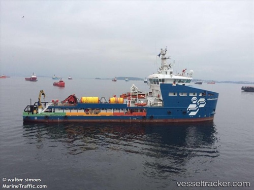
 FERNANDO DE NORONHA
Current Status
Where is the vessel?
FERNANDO DE NORONHA is currently in Near Cidade de Angra dos Reis FPSO, based on AIS data received less than 1h ago.
Latest AIS update:
Current position: 25.58777° S, 43.00371° W (Near Cidade de Angra dos Reis FPSO)
Average speed (last 7 days): Loading…
Average speed (last 30 days): Loading…
Vessel profile: FERNANDO DE NORONHA is a Pollution Control Vessel with dimensions m x m.
This page combines live AIS, route history, probable destination signals, nearby traffic, and port activity for practical vessel monitoring.
The current position of vessel FERNANDO DE NORONHA is -25.58777 lat / -43.00371 lng. Updated: 2026-05-18 01:55:14 UTCNearest reference points:
- 34 nm S of Cidade de Angra dos Reis FPSO
- 69 nm NE of Cidade de Angra dos Reis FPSO
- 61 nm S of TEBIG
Currently sailing under the flag of Brazil ![]()
FERNANDO DE NORONHA built in 2016 year
Deadweight:
1708 tDetails:
Live Vessel FERNANDO DE NORONHA Analytics (details, animations, etc.)
Recent AIS points (UTC):
2026-05-17 22:35:24 UTC · -25.58789, -43.00589 · SOG 0.2 kn · COG 5°2026-05-18 00:12:31 UTC · -25.58792, -43.00461 · SOG 0.3 kn · COG 355°
2026-05-18 00:53:42 UTC · -25.58790, -43.00458 · SOG 0.4 kn · COG 350°
2026-05-18 01:55:14 UTC · -25.58777, -43.00371 · SOG 0.2 kn · COG 344°