 vesseltracker.com
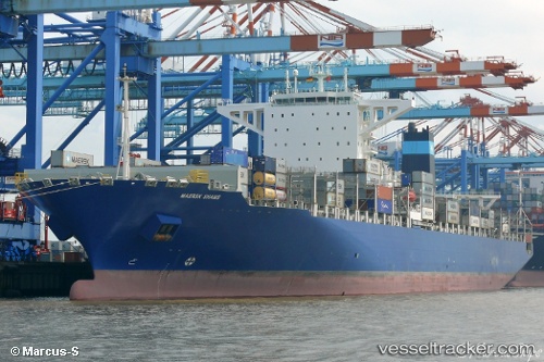
Maersk Shams
Current StatusWhere is the vessel?
Maersk Shams is currently in 17 nm SE of Isle of Palms, based on AIS data received less than 1h ago.
Latest AIS update:
Current position: 32.53393° N, 79.59402° W (17 nm SE of Isle of Palms)
Average speed (last 7 days): Loading…
Average speed (last 30 days): Loading…
Vessel profile: Maersk Shams is a Container Ship with dimensions 48m x 299m.
This page combines live AIS, route history, probable destination signals, nearby traffic, and port activity for practical vessel monitoring.
The current position of vessel Maersk Shams is 32.53393 lat / -79.59402 lng. Updated: 2026-05-17 20:11:17 UTCNearest reference points:
- Near Charleston
- 33 nm S of Kiawah Island
- Near Saint Andrews
Details:
Live Vessel Maersk Shams Analytics (details, animations, etc.)
Recent AIS points (UTC):
2026-05-17 16:11:19 UTC · 32.53248, -79.59173 · SOG 0 kn · COG 272°2026-05-17 17:20:16 UTC · 32.53260, -79.59193 · SOG 0 kn · COG 268°
2026-05-17 19:50:16 UTC · 32.53401, -79.59394 · SOG 0 kn · COG 143°
2026-05-17 20:11:17 UTC · 32.53393, -79.59402 · SOG 0 kn · COG 136°