 vesseltracker.com
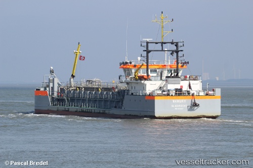
 MAHURY
Current Status
Where is the vessel?
MAHURY is currently in Near Nieuw Amsterdam, based on AIS data received about 1h ago.
Latest AIS update:
Current position: 5.86523° N, 55.09536° W (Near Nieuw Amsterdam)
Average speed (last 7 days): Loading…
Average speed (last 30 days): Loading…
Vessel profile: MAHURY is a Hopper Dredger with dimensions 13m x 75m.
This page combines live AIS, route history, probable destination signals, nearby traffic, and port activity for practical vessel monitoring.
The current position of vessel MAHURY is 5.86523 lat / -55.09536 lng. Updated: 2026-05-17 13:55:45 UTCNearest reference points:
- Near Paramaribo Zorg en Hoop Airport
- 38 nm NW of Jarikaba
Currently sailing under the flag of Netherlands ![]()
MAHURY built in 2016 year
Deadweight:
1623 tDetails:
Live Vessel MAHURY Analytics (details, animations, etc.)
Recent AIS points (UTC):
2026-05-17 10:12:45 UTC · 5.86685, -55.09403 · SOG 2.5 kn · COG 160°2026-05-17 12:19:18 UTC · 5.86647, -55.09645 · SOG 1.6 kn · COG 171°
2026-05-17 13:13:53 UTC · 5.86773, -55.09484 · SOG 3.1 kn · COG 213°
2026-05-17 13:55:45 UTC · 5.86523, -55.09536 · SOG 1.5 kn · COG 164°