 vesseltracker.com
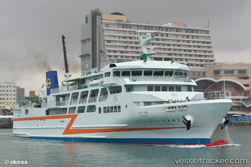
Ferry Zamami3
Current StatusWhere is the vessel?
Ferry Zamami3 is currently in 20 nm W of Tomigusuku, Okinawa, based on AIS data received about 1h ago.
Latest AIS update:
Current position: 26.21647° N, 127.29963° E (20 nm W of Tomigusuku, Okinawa)
Average speed (last 7 days): Loading…
Average speed (last 30 days): Loading…
Vessel profile: Ferry Zamami3 is a Passenger Ro Ro Cargo Ship with dimensions 14m x 71m.
This page combines live AIS, route history, probable destination signals, nearby traffic, and port activity for practical vessel monitoring.
The current position of vessel Ferry Zamami3 is 26.21647 lat / 127.29963 lng. Updated: 2026-05-17 02:54:26 UTCNearest reference points:
- 77 nm SE of Miyakojima
- 18 nm W of Koniya
Details:
Live Vessel Ferry Zamami3 Analytics (details, animations, etc.)
Recent AIS points (UTC):
2026-05-16 08:09:30 UTC · 26.22511, 127.68372 · SOG 0 kn · COG 11°2026-05-17 01:21:34 UTC · 26.21366, 127.59262 · SOG 18.6 kn · COG 253°
2026-05-17 02:10:52 UTC · 26.13552, 127.33370 · SOG 18.1 kn · COG 327°
2026-05-17 02:54:26 UTC · 26.21647, 127.29963 · SOG 17.6 kn · COG 334°