 vesseltracker.com
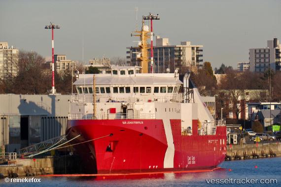
 Sir John Franklin
Current Status
Where is the vessel?
Sir John Franklin is currently in 42 nm SW of UCLUELET, based on AIS data received about 1h ago.
Latest AIS update:
Current position: 48.66715° N, 126.50772° W (42 nm SW of UCLUELET)
Average speed (last 7 days): Loading…
Average speed (last 30 days): Loading…
Vessel profile: Sir John Franklin is a Fishing Vessel with dimensions 64m x 16m.
This page combines live AIS, route history, probable destination signals, nearby traffic, and port activity for practical vessel monitoring.
The current position of vessel Sir John Franklin is 48.66715 lat / -126.50772 lng. Updated: 2026-05-17 17:53:21 UTCNearest reference points:
- 21 nm NW of Tatoosh Island
- Near Clallam Bay
- Near PORT HARDY
Currently sailing under the flag of Canada ![]()
Details:
Live Vessel Sir John Franklin Analytics (details, animations, etc.)
Recent AIS points (UTC):
2026-05-17 13:49:13 UTC · 48.56775, -126.50998 · SOG 8 kn · COG 131°2026-05-17 15:29:01 UTC · 48.57180, -126.56882 · SOG 2.7 kn · COG 291°
2026-05-17 16:58:54 UTC · 48.67500, -126.57745 · SOG 4.5 kn · COG 105°
2026-05-17 17:53:21 UTC · 48.66715, -126.50772 · SOG 0.4 kn · COG 258°