 vesseltracker.com
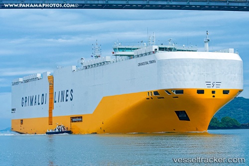
 GRANDE BALTIMORA
Current Status
Where is the vessel?
GRANDE BALTIMORA is currently in 22 nm E of PORTO VECCHIO, based on AIS data received less than 1h ago.
Latest AIS update:
Current position: 41.47778° N, 9.75480° E (22 nm E of PORTO VECCHIO)
Average speed (last 7 days): Loading…
Average speed (last 30 days): Loading…
Vessel profile: GRANDE BALTIMORA is a Cargo with dimensions m x m.
This page combines live AIS, route history, probable destination signals, nearby traffic, and port activity for practical vessel monitoring.
The current position of vessel GRANDE BALTIMORA is 41.47778 lat / 9.75480 lng. Updated: 2026-05-17 07:10:07 UTCNearest reference points:
- 16 nm NE of Golfo Aranci
- Near La Maddalena
- Near Golfo Aranci
Currently sailing under the flag of Malta ![]()
Details:
Live Vessel GRANDE BALTIMORA Analytics (details, animations, etc.)
Recent AIS points (UTC):
2026-05-17 03:47:57 UTC · 41.26913, 8.59628 · SOG 17.1 kn · COG 79°2026-05-17 04:07:07 UTC · 41.28261, 8.71607 · SOG 17.4 kn · COG 81°
2026-05-17 05:28:13 UTC · 41.28086, 9.23330 · SOG 17.7 kn · COG 90°
2026-05-17 07:10:07 UTC · 41.47778, 9.75480 · SOG 15.1 kn · COG 67°