 vesseltracker.com
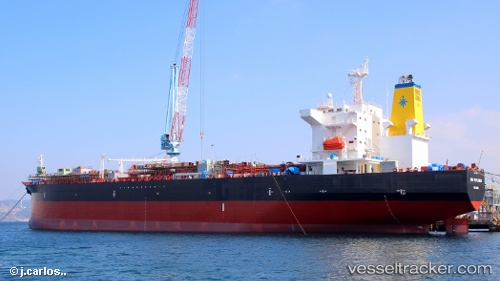
 High Explorer
Current Status
Where is the vessel?
High Explorer is currently in 149 nm N of ISLA MUJERES, based on AIS data received less than 1h ago.
Latest AIS update:
Current position: 23.72167° N, 86.88500° W (149 nm N of ISLA MUJERES)
Average speed (last 7 days): Loading…
Average speed (last 30 days): Loading…
Vessel profile: High Explorer is a Chemical Oil Products Tanker with dimensions 182m x 182m.
This page combines live AIS, route history, probable destination signals, nearby traffic, and port activity for practical vessel monitoring.
The current position of vessel High Explorer is 23.72167 lat / -86.88500 lng. Updated: 2026-05-17 07:29:40 UTCCurrently sailing under the flag of Luxembourg ![]()
High Explorer built in 0 year
Deadweight:
0 tDetails:
Live Vessel High Explorer Analytics (details, animations, etc.)
Recent AIS points (UTC):
2026-05-17 03:56:39 UTC · 22.96833, -86.46500 · SOG 14 kn · COG -1°2026-05-17 05:08:39 UTC · 23.22333, -86.60500 · SOG 14 kn · COG -1°
2026-05-17 05:32:42 UTC · 23.30833, -86.65333 · SOG 14 kn · COG -1°
2026-05-17 07:29:40 UTC · 23.72167, -86.88500 · SOG 14 kn · COG -1°