 vesseltracker.com
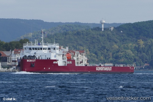
Berkut
Current StatusWhere is the vessel?
Berkut is currently in Near Aktau, based on AIS data received about 1h ago.
Latest AIS update:
Current position: 43.48750° N, 51.13363° E (Near Aktau)
Average speed (last 7 days): Loading…
Average speed (last 30 days): Loading…
Vessel profile: Berkut is a Deck Cargo Ship with dimensions 21m x 113m.
This page combines live AIS, route history, probable destination signals, nearby traffic, and port activity for practical vessel monitoring.
The current position of vessel Berkut is 43.48750 lat / 51.13363 lng. Updated: 2026-05-17 10:43:00 UTCNearest reference points:
- 12 nm S of Aktau
- 24 nm W of Kuryk
- 35 nm W of Kuryk
Details:
Live Vessel Berkut Analytics (details, animations, etc.)
Recent AIS points (UTC):
2026-05-17 07:51:24 UTC · 43.59950, 51.21916 · SOG 0 kn · COG 334°2026-05-17 08:00:24 UTC · 43.59950, 51.21915 · SOG 0 kn · COG 335°
2026-05-17 09:53:01 UTC · 43.57615, 51.16314 · SOG 6.3 kn · COG 196°
2026-05-17 10:43:00 UTC · 43.48750, 51.13363 · SOG 6.6 kn · COG 192°