 vesseltracker.com
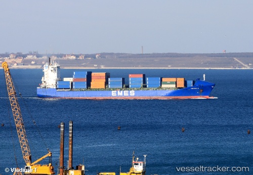
Find the position of the vessel Yigitcan A on the map. The latter are known coordinates and path.
marine traffic ship tracker show on live map
The current position of vessel Yigitcan A is 36.9899 lat / 5.15445 lng. Updated: 2024-05-03 21:45:52 UTCCurrently sailing under the flag of Malta
Yigitcan A built in 2001 year
Port of registry:
İzmir (city in İzmir Province, Turkey)Deadweight:
17264 tGross tonnage:
14193Operator:
ARKAS Line (shipping company of Turkey)Service entry:
2001-01-01T00:00:00ZManufacturer:
Peene-Werft (German company)
Details:
Last coordinates of the vessel:
UTC, 36.9017, 5.19167, course: -1, speed: 0UTC, 36.8941, 5.19956, course: 11, speed: 0.2
UTC, 36.8918, 5.20117, course: 11, speed: 0.3
2024-05-03 21:45:52 UTC, 36.9899, 5.15445, course: 341, speed: 3.4