 vesseltracker.com
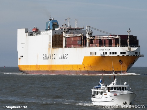
 GRANDE AFRICA
Current Status
Where is the vessel?
GRANDE AFRICA is currently in Near Yof, based on AIS data received less than 1h ago.
Latest AIS update:
Current position: 14.87360° N, 17.57230° W (Near Yof)
Average speed (last 7 days): Loading…
Average speed (last 30 days): Loading…
Vessel profile: GRANDE AFRICA is a Ro-Ro Cargo Ship with dimensions 32m x 214m.
This page combines live AIS, route history, probable destination signals, nearby traffic, and port activity for practical vessel monitoring.
The current position of vessel GRANDE AFRICA is 14.8736 lat / -17.5723 lng. Updated: 2026-04-26 17:35:24 UTCNearest reference points:
- Near Dakar
- Near Rufisque
- Near Banjul
Currently sailing under the flag of Malta ![]()
GRANDE AFRICA built in 1998 year
Deadweight:
27965 tDetails:
Live Vessel GRANDE AFRICA Analytics (details, animations, etc.)
Recent AIS points (UTC):
2026-04-26 14:20:45 UTC · 15.56240, -17.56320 · SOG 12.6 kn · COG 180°2026-04-26 16:14:26 UTC · 15.16170, -17.56870 · SOG 12.4 kn · COG 182°
2026-04-26 16:15:52 UTC · 15.15710, -17.56880 · SOG 12.5 kn · COG 182°
2026-04-26 17:35:24 UTC · 14.87360, -17.57230 · SOG 12.9 kn · COG 178°