 vesseltracker.com
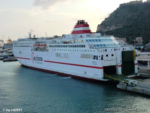
 Ciudad De Granada
Current Status
Where is the vessel?
Ciudad De Granada is currently in Near Barcelona, based on AIS data received about 1h ago.
Latest AIS update:
Current position: 41.37149° N, 2.17906° E (Near Barcelona)
Average speed (last 7 days): Loading…
Average speed (last 30 days): Loading…
Vessel profile: Ciudad De Granada is a Passenger Ro Ro Cargo Ship with dimensions 174m x 27m.
This page combines live AIS, route history, probable destination signals, nearby traffic, and port activity for practical vessel monitoring.
The current position of vessel Ciudad De Granada is 41.37149 lat / 2.17906 lng. Updated: 2026-04-07 17:50:59 UTCNearest reference points:
- Near Barcelona
- Near Zona Franca de Barcelona
- Near BADALONA
Currently sailing under the flag of Spain ![]()
Ciudad De Granada built in 2001 year
Deadweight:
5000 tDetails:
Live Vessel Ciudad De Granada Analytics (details, animations, etc.)
Recent AIS points (UTC):
2026-04-07 11:57:31 UTC · 40.36357, 3.78320 · SOG 20 kn · COG 311°2026-04-07 14:13:37 UTC · 40.85124, 2.99516 · SOG 20.3 kn · COG 310°
2026-04-07 16:24:31 UTC · 41.33382, 2.22870 · SOG 21.3 kn · COG 289°
2026-04-07 17:50:59 UTC · 41.37149, 2.17906 · SOG 0 kn · COG -1°