 vesseltracker.com
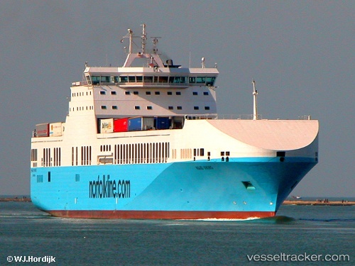
 POL STELLA
Current Status
Where is the vessel?
POL STELLA is currently in 39 nm NE of BIZERTE, based on AIS data received about 2h ago.
Latest AIS update:
Current position: 37.75286° N, 10.39070° E (39 nm NE of BIZERTE)
Average speed (last 7 days): Loading…
Average speed (last 30 days): Loading…
Vessel profile: POL STELLA is a Ro-Ro Cargo Ship with dimensions 193m x 26m.
This page combines live AIS, route history, probable destination signals, nearby traffic, and port activity for practical vessel monitoring.
The current position of vessel POL STELLA is 37.75286 lat / 10.39070 lng. Updated: 2026-05-15 00:30:42 UTCNearest reference points:
- 32 nm N of Qulaybiyah
- Near Le Kram
- 13 nm N of Qulaybiyah
Currently sailing under the flag of Malta ![]()
POL STELLA built in 2009 year
Deadweight:
11636 tDetails:
Live Vessel POL STELLA Analytics (details, animations, etc.)
Recent AIS points (UTC):
2026-05-14 21:59:02 UTC · 38.28448, 10.33459 · SOG 12.8 kn · COG 179°2026-05-14 22:36:22 UTC · 38.15212, 10.34660 · SOG 13.2 kn · COG 175°
2026-05-14 23:56:33 UTC · 37.87225, 10.37749 · SOG 12.3 kn · COG 177°
2026-05-15 00:30:42 UTC · 37.75286, 10.39070 · SOG 13.3 kn · COG 177°