 vesseltracker.com
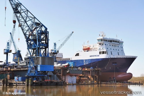
 Norstream
Current Status
Where is the vessel?
Norstream is currently in Near Gravesend, based on AIS data received less than 1h ago.
Latest AIS update:
Current position: 51.44984° N, 0.40927° E (Near Gravesend)
Average speed (last 7 days): Loading…
Average speed (last 30 days): Loading…
Vessel profile: Norstream is a Ro Ro Cargo Ship with dimensions 180m x 26m.
This page combines live AIS, route history, probable destination signals, nearby traffic, and port activity for practical vessel monitoring.
The current position of vessel Norstream is 51.44984 lat / 0.40927 lng. Updated: 2026-04-28 06:09:29 UTCNearest reference points:
- Near Gravesend
- Near GILLINGHAM
- Near Blackheath/London
Currently sailing under the flag of Finland ![]()
Norstream built in 1999 year
Deadweight:
11585 tDetails:
Live Vessel Norstream Analytics (details, animations, etc.)
Recent AIS points (UTC):
2026-04-28 02:25:00 UTC · 51.55792, 1.74037 · SOG 16.8 kn · COG 238°2026-04-28 04:00:28 UTC · 51.48840, 1.16651 · SOG 9.4 kn · COG 279°
2026-04-28 04:49:58 UTC · 51.49020, 0.88836 · SOG 16.9 kn · COG 289°
2026-04-28 06:09:29 UTC · 51.44984, 0.40927 · SOG 11.5 kn · COG 272°