 vesseltracker.com
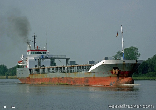
Vessel NATHALIE IMO: 9259068, MMSI: 230698000 General Cargo Ship
UTC, 53.09494, 7.37411, course: -1, speed: 0
UTC, 53.09493, 7.37409, course: -1, speed: 0
2026-03-02 15:41:06 UTC, 53.09488, 7.37415, course: -1, speed: 0
Live AIS position:
UTC. Near PAPENBURG),
updated 2026-03-02 15:41:06 UTC.
Find the position of the vessel NATHALIE on the map. The latter are known coordinates and path.
marine traffic ship tracker show on live map
The current position of vessel NATHALIE is 53.09488 lat / 7.37415 lng. Updated: 2026-03-02 15:41:06 UTCCurrently sailing under the flag of Finland
NATHALIE built in 2003 year
Deadweight:
5019 tDetails:
Last coordinates of the vessel:
UTC, 53.09497, 7.37406, course: -1, speed: 0UTC, 53.09494, 7.37411, course: -1, speed: 0
UTC, 53.09493, 7.37409, course: -1, speed: 0
2026-03-02 15:41:06 UTC, 53.09488, 7.37415, course: -1, speed: 0