 vesseltracker.com
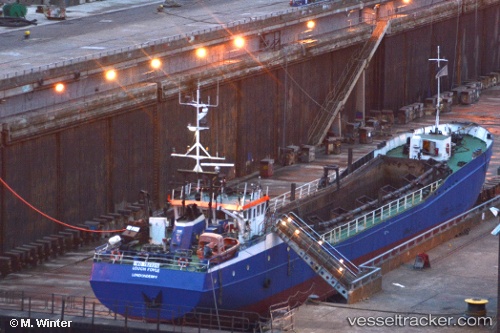
 Lough Foyle
Current Status
Where is the vessel?
Lough Foyle is currently in Near Maydown, based on AIS data received about 13h ago.
Latest AIS update:
Current position: 55.04288° N, 7.26008° W (Near Maydown)
Average speed (last 7 days): Loading…
Average speed (last 30 days): Loading…
Vessel profile: Lough Foyle is a Hopper Dredger with dimensions 75m x 10m.
This page combines live AIS, route history, probable destination signals, nearby traffic, and port activity for practical vessel monitoring.
The current position of vessel Lough Foyle is 55.04288 lat / -7.26008 lng. Updated: 2026-04-10 08:07:33 UTCNearest reference points:
- Near Belfast
- Near GREENORE
- Near Greencastle
Currently sailing under the flag of United Kingdom ![]()
Lough Foyle built in 1979 year
Details:
Live Vessel Lough Foyle Analytics (details, animations, etc.)
Recent AIS points (UTC):
2026-04-10 02:37:02 UTC · 55.04290, -7.26006 · SOG 0 kn · COG 45°2026-04-10 04:21:03 UTC · 55.04293, -7.26010 · SOG 0 kn · COG 46°
2026-04-10 05:21:01 UTC · 55.04294, -7.26009 · SOG 0 kn · COG 44°
2026-04-10 08:07:33 UTC · 55.04288, -7.26008 · SOG 0 kn · COG 45°