 vesseltracker.com
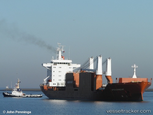
Spuigracht
Current StatusWhere is the vessel?
Spuigracht is currently in Near Vila do Conde Pt/Barcarena, based on AIS data received less than 1h ago.
Latest AIS update:
Current position: 1.55170° S, 48.80701° W (Near Vila do Conde Pt/Barcarena)
Average speed (last 7 days): Loading…
Average speed (last 30 days): Loading…
Vessel profile: Spuigracht is a General Cargo Ship with dimensions 26m x 174m.
This page combines live AIS, route history, probable destination signals, nearby traffic, and port activity for practical vessel monitoring.
The current position of vessel Spuigracht is -1.55170 lat / -48.80701 lng. Updated: 2026-05-15 22:37:29 UTCNearest reference points:
- Near Belem
- Near Santana
- 55 nm N of Tucuma
Details:
Live Vessel Spuigracht Analytics (details, animations, etc.)
Recent AIS points (UTC):
2026-05-15 19:50:33 UTC · -1.54977, -48.80440 · SOG 0 kn · COG 285°2026-05-15 19:58:36 UTC · -1.54984, -48.80442 · SOG 0 kn · COG 288°
2026-05-15 22:09:20 UTC · -1.55189, -48.80667 · SOG 0.4 kn · COG 20°
2026-05-15 22:37:29 UTC · -1.55170, -48.80701 · SOG 0 kn · COG 34°