 vesseltracker.com
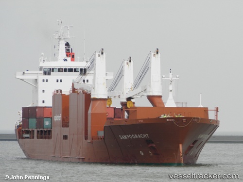
 Sampogracht
Current Status
Where is the vessel?
Sampogracht is currently in 14 nm NW of Great Stirrup Cay, based on AIS data received about 1h ago.
Latest AIS update:
Current position: 26.03427° N, 78.04377° W (14 nm NW of Great Stirrup Cay)
Average speed (last 7 days): Loading…
Average speed (last 30 days): Loading…
Vessel profile: Sampogracht is a Multi Purpose Carrier with dimensions 185m x 25m.
This page combines live AIS, route history, probable destination signals, nearby traffic, and port activity for practical vessel monitoring.
The current position of vessel Sampogracht is 26.03427 lat / -78.04377 lng. Updated: 2026-04-15 05:49:28 UTCNearest reference points:
- 27 nm SE of Gorda Cay
- 44 nm S of Freeport
- Near Green Turtle Cay
Currently sailing under the flag of Netherlands ![]()
Sampogracht built in 2005 year
Deadweight:
23688 tDetails:
Live Vessel Sampogracht Analytics (details, animations, etc.)
Recent AIS points (UTC):
2026-04-14 22:19:54 UTC · 26.71526, -79.84637 · SOG 13.3 kn · COG 116°2026-04-15 00:27:42 UTC · 26.53524, -79.36011 · SOG 14.5 kn · COG 114°
2026-04-15 03:45:58 UTC · 26.23697, -78.56350 · SOG 14.4 kn · COG 114°
2026-04-15 05:49:28 UTC · 26.03427, -78.04377 · SOG 15.1 kn · COG 115°