 vesseltracker.com
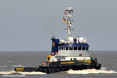
 Dutch Power
Current Status
Where is the vessel?
Dutch Power is currently in Near Holbury, based on AIS data received about 1h ago.
Latest AIS update:
Current position: 50.53425° N, 1.47385° W (Near Holbury)
Average speed (last 7 days): Loading…
Average speed (last 30 days): Loading…
Vessel profile: Dutch Power is a Tug with dimensions 30m x 31m.
This page combines live AIS, route history, probable destination signals, nearby traffic, and port activity for practical vessel monitoring.
The current position of vessel Dutch Power is 50.53425 lat / -1.47385 lng. Updated: 2026-04-08 06:26:17 UTCNearest reference points:
- 11 nm SW of Holbury
- Near Yarmouth
- Near LYMINGTON
Currently sailing under the flag of Netherlands ![]()
Dutch Power built in 2009 year
Deadweight:
130 tDetails:
Live Vessel Dutch Power Analytics (details, animations, etc.)
Recent AIS points (UTC):
2026-04-08 00:19:07 UTC · 50.52740, -0.75494 · SOG 2.3 kn · COG 263°2026-04-08 01:58:08 UTC · 50.52615, -0.87137 · SOG 3.7 kn · COG 270°
2026-04-08 04:00:17 UTC · 50.52348, -1.11553 · SOG 5.3 kn · COG 281°
2026-04-08 06:26:17 UTC · 50.53425, -1.47385 · SOG 5.1 kn · COG 267°