 vesseltracker.com
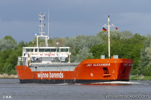
 Lady Alexandra
Current Status
Where is the vessel?
Lady Alexandra is currently in Near Cabo de Palos, based on AIS data received about 14h ago.
Latest AIS update:
Current position: 37.55713° N, 0.51101° W (Near Cabo de Palos)
Average speed (last 7 days): Loading…
Average speed (last 30 days): Loading…
Vessel profile: Lady Alexandra is a General Cargo Ship with dimensions 88m x 88m.
This page combines live AIS, route history, probable destination signals, nearby traffic, and port activity for practical vessel monitoring.
The current position of vessel Lady Alexandra is 37.55713 lat / -0.51101 lng. Updated: 2026-04-10 07:53:58 UTCNearest reference points:
- Near Torre Horadada
- Near Playa San Agustin
- Near ESCOMBRERAS
Currently sailing under the flag of Netherlands ![]()
Lady Alexandra built in 2012 year
Deadweight:
3700 tDetails:
Live Vessel Lady Alexandra Analytics (details, animations, etc.)
Recent AIS points (UTC):
2026-04-10 02:30:50 UTC · 37.03667, -1.24667 · SOG 8 kn · COG -1°2026-04-10 04:18:51 UTC · 37.20833, -1.00333 · SOG 8 kn · COG -1°
2026-04-10 05:26:15 UTC · 37.31836, -0.84709 · SOG 8.9 kn · COG 50°
2026-04-10 07:53:58 UTC · 37.55713, -0.51101 · SOG 8.3 kn · COG 46°