 vesseltracker.com
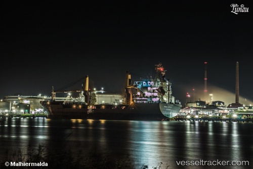
 SIDER SONJA
Current Status
Where is the vessel?
SIDER SONJA is currently in Near PORTO TORRES, based on AIS data received about 1h ago.
Latest AIS update:
Current position: 40.84385° N, 8.37824° E (Near PORTO TORRES)
Average speed (last 7 days): Loading…
Average speed (last 30 days): Loading…
Vessel profile: SIDER SONJA is a General Cargo Ship with dimensions 109m x 108m.
This page combines live AIS, route history, probable destination signals, nearby traffic, and port activity for practical vessel monitoring.
The current position of vessel SIDER SONJA is 40.84385 lat / 8.37824 lng. Updated: 2026-04-23 19:49:48 UTCNearest reference points:
- Near Valledoria
- Near Propriano
- Near La Maddalena
Currently sailing under the flag of Italy ![]()
SIDER SONJA built in 2008 year
Deadweight:
8063 tDetails:
Live Vessel SIDER SONJA Analytics (details, animations, etc.)
Recent AIS points (UTC):
2026-04-23 16:10:36 UTC · 40.84384, 8.37824 · SOG 0 kn · COG 180°2026-04-23 18:03:48 UTC · 40.84385, 8.37822 · SOG 0 kn · COG 180°
2026-04-23 19:42:34 UTC · 40.84383, 8.37824 · SOG 0 kn · COG 180°
2026-04-23 19:49:48 UTC · 40.84385, 8.37824 · SOG 0 kn · COG 180°