 vesseltracker.com
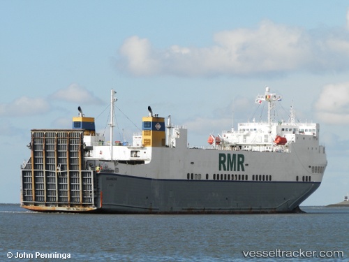
 Celandine
Current Status
Where is the vessel?
Celandine is currently in Near Nieuwdorp, based on AIS data received less than 1h ago.
Latest AIS update:
Current position: 51.46058° N, 3.68181° E (Near Nieuwdorp)
Average speed (last 7 days): Loading…
Average speed (last 30 days): Loading…
Vessel profile: Celandine is a Ro Ro Cargo Ship with dimensions 162m x 25m.
This page combines live AIS, route history, probable destination signals, nearby traffic, and port activity for practical vessel monitoring.
The current position of vessel Celandine is 51.46058 lat / 3.68181 lng. Updated: 2026-04-26 07:30:18 UTCNearest reference points:
- Near Nieuwdorp
- Near Borssele
- Near BASTIAAN DE LANGEPLA
Currently sailing under the flag of Malta ![]()
Celandine built in 2000 year
Deadweight:
9415 tDetails:
Live Vessel Celandine Analytics (details, animations, etc.)
Recent AIS points (UTC):
2026-04-26 03:20:38 UTC · 51.46059, 3.68181 · SOG 0 kn · COG 181°2026-04-26 04:48:25 UTC · 51.46061, 3.68177 · SOG 0 kn · COG 181°
2026-04-26 06:12:22 UTC · 51.46061, 3.68181 · SOG 0 kn · COG 181°
2026-04-26 07:30:18 UTC · 51.46058, 3.68181 · SOG 0 kn · COG 181°