 vesseltracker.com
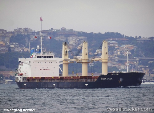
Vessel SIDER LUCK IMO: 9495595, MMSI: 255779000 General Cargo Ship
UTC, 43.40125, 3.71608, course: 341, speed: 0
UTC, 43.40124, 3.71606, course: -1, speed: 0
2026-03-02 06:26:24 UTC, 43.40123, 3.71605, course: 341, speed: 0
Live AIS position:
UTC. Near Sete),
updated 2026-03-02 06:26:24 UTC.
Find the position of the vessel SIDER LUCK on the map. The latter are known coordinates and path.
marine traffic ship tracker show on live map
The current position of vessel SIDER LUCK is 43.40123 lat / 3.71605 lng. Updated: 2026-03-02 06:26:24 UTCCurrently sailing under the flag of Portugal (MAR)
SIDER LUCK built in 2012 year
Deadweight:
26307 tDetails:
Last coordinates of the vessel:
UTC, 43.40122, 3.71604, course: 341, speed: 0UTC, 43.40125, 3.71608, course: 341, speed: 0
UTC, 43.40124, 3.71606, course: -1, speed: 0
2026-03-02 06:26:24 UTC, 43.40123, 3.71605, course: 341, speed: 0