 vesseltracker.com
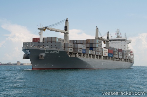
Ulanga
Current StatusWhere is the vessel?
Ulanga is currently in Near Monrovia, based on AIS data received less than 1h ago.
Latest AIS update:
Current position: 6.34398° N, 10.87698° W (Near Monrovia)
Average speed (last 7 days): Loading…
Average speed (last 30 days): Loading…
Vessel profile: Ulanga is a Container Ship with dimensions 30m x 185m.
This page combines live AIS, route history, probable destination signals, nearby traffic, and port activity for practical vessel monitoring.
The current position of vessel Ulanga is 6.34398 lat / -10.87698 lng. Updated: 2026-04-25 22:05:35 UTCNearest reference points:
- 15 nm SW of Buchanan
- 110 nm SW of River Cess
- Near Kissy
Details:
Live Vessel Ulanga Analytics (details, animations, etc.)
Recent AIS points (UTC):
2026-04-25 19:47:36 UTC · 6.34310, -10.87548 · SOG 0.2 kn · COG 335°2026-04-25 19:47:36 UTC · 6.34310, -10.87548 · SOG 0.2 kn · COG 335°
2026-04-25 21:23:36 UTC · 6.34365, -10.87692 · SOG 0.3 kn · COG 56°
2026-04-25 22:05:35 UTC · 6.34398, -10.87698 · SOG 0.3 kn · COG 80°