 vesseltracker.com
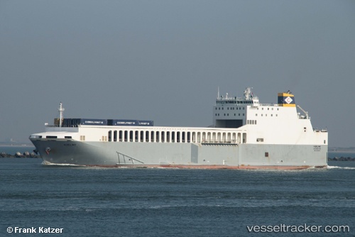
 Adeline
Current Status
Where is the vessel?
Adeline is currently in Near Nieuwdorp, based on AIS data received less than 1h ago.
Latest AIS update:
Current position: 51.46153° N, 3.68168° E (Near Nieuwdorp)
Average speed (last 7 days): Loading…
Average speed (last 30 days): Loading…
Vessel profile: Adeline is a Ro Ro Cargo Ship with dimensions 152m x 24m.
This page combines live AIS, route history, probable destination signals, nearby traffic, and port activity for practical vessel monitoring.
The current position of vessel Adeline is 51.46153 lat / 3.68168 lng. Updated: 2026-04-28 10:06:54 UTCNearest reference points:
- Near Nieuwdorp
- Near Borssele
- Near BASTIAAN DE LANGEPLA
Currently sailing under the flag of Malta ![]()
Adeline built in 2012 year
Deadweight:
6374 tDetails:
Live Vessel Adeline Analytics (details, animations, etc.)
Recent AIS points (UTC):
2026-04-28 06:09:32 UTC · 51.41434, 3.02933 · SOG 12.3 kn · COG 110°2026-04-28 08:07:05 UTC · 51.46072, 3.68137 · SOG 1.8 kn · COG 171°
2026-04-28 08:21:56 UTC · 51.46154, 3.68169 · SOG 0 kn · COG 180°
2026-04-28 10:06:54 UTC · 51.46153, 3.68168 · SOG 0 kn · COG 180°