 vesseltracker.com
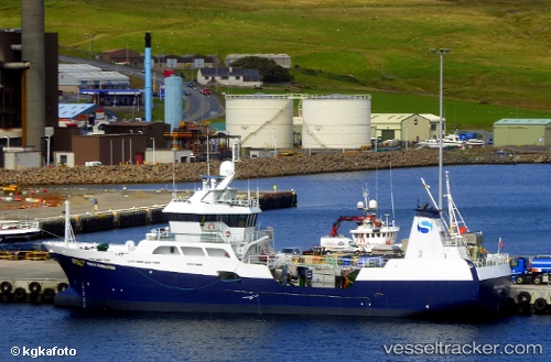
 Ronja Commander
Current Status
Where is the vessel?
Ronja Commander is currently in Near OBAN, based on AIS data received less than 1h ago.
Latest AIS update:
Current position: 56.41181° N, 5.48120° W (Near OBAN)
Average speed (last 7 days): Loading…
Average speed (last 30 days): Loading…
Vessel profile: Ronja Commander is a Fish Carrier with dimensions 55m x 55m.
This page combines live AIS, route history, probable destination signals, nearby traffic, and port activity for practical vessel monitoring.
The current position of vessel Ronja Commander is 56.41181 lat / -5.48120 lng. Updated: 2026-03-29 08:21:00 UTCNearest reference points:
- Near OBAN
- Near DUNSTAFFNAGE
- Near CRAIGNURE PIER
Currently sailing under the flag of Norway ![]()
Details:
Live Vessel Ronja Commander Analytics (details, animations, etc.)
Recent AIS points (UTC):
2026-03-29 01:09:02 UTC · 56.41174, -5.48141 · SOG 0 kn · COG 113°2026-03-29 03:25:57 UTC · 56.41184, -5.48133 · SOG 0 kn · COG 111°
2026-03-29 05:51:02 UTC · 56.41195, -5.48131 · SOG 0 kn · COG 112°
2026-03-29 08:21:00 UTC · 56.41181, -5.48120 · SOG 0 kn · COG 111°