 vesseltracker.com
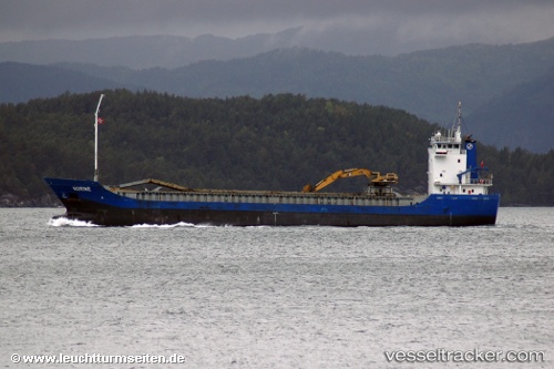
Vessel Norne IMO: 9082403, MMSI: 258763000 Multi Purpose Carrier
UTC, 62.63716, 6.56548, course: 253, speed: 10.7
UTC, 62.45391, 6.04608, course: 203, speed: 10.1
2026-03-01 23:27:35 UTC, 62.27581, 5.97727, course: 227, speed: 10.4
Live AIS position:
UTC. Near Vartdal),
updated 2026-03-01 23:27:35 UTC.
Find the position of the vessel Norne on the map. The latter are known coordinates and path.
marine traffic ship tracker show on live map
The current position of vessel Norne is 62.27581 lat / 5.97727 lng. Updated: 2026-03-01 23:27:35 UTCCurrently sailing under the flag of Norway
Norne built in 1996 year
Deadweight:
4818 tDetails:
Last coordinates of the vessel:
UTC, 62.76830, 7.44160, course: 75, speed: 0UTC, 62.63716, 6.56548, course: 253, speed: 10.7
UTC, 62.45391, 6.04608, course: 203, speed: 10.1
2026-03-01 23:27:35 UTC, 62.27581, 5.97727, course: 227, speed: 10.4