 vesseltracker.com
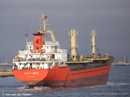
 Akaylar Ii
Current Status
Where is the vessel?
Akaylar Ii is currently in Near BIZERTE, based on AIS data received about 1h ago.
Latest AIS update:
Current position: 37.27500° N, 9.98833° E (Near BIZERTE)
Average speed (last 7 days): Loading…
Average speed (last 30 days): Loading…
Vessel profile: Akaylar Ii is a General Cargo Ship with dimensions 91m x 14m.
This page combines live AIS, route history, probable destination signals, nearby traffic, and port activity for practical vessel monitoring.
The current position of vessel Akaylar Ii is 37.27500 lat / 9.98833 lng. Updated: 2026-04-07 12:01:52 UTCNearest reference points:
- Near Le Kram
- 33 nm SE of Setubal
- 32 nm N of Qulaybiyah
Currently sailing under the flag of Turkey ![]()
Akaylar Ii built in 1993 year
Deadweight:
4263 tDetails:
Live Vessel Akaylar Ii Analytics (details, animations, etc.)
Recent AIS points (UTC):
2026-04-07 06:13:24 UTC · 37.27509, 9.99118 · SOG 0 kn · COG -1°2026-04-07 07:28:05 UTC · 37.27534, 9.99137 · SOG 0 kn · COG 276°
2026-04-07 10:23:14 UTC · 37.27602, 9.99099 · SOG 0.2 kn · COG 226°
2026-04-07 12:01:52 UTC · 37.27500, 9.98833 · SOG 0 kn · COG -1°