 vesseltracker.com
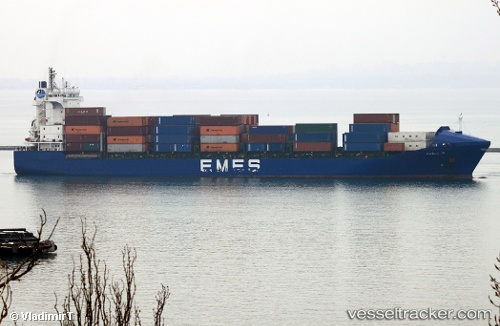
Vessel Karla A IMO: 9297577, MMSI: 271000744 Container Ship
UTC, 36.77378, 3.12684, course: 342, speed: 0
UTC, 36.77387, 3.12621, course: 6, speed: 0
2026-03-02 08:21:39 UTC, 36.77333, 3.12500, course: -1, speed: 0
Live AIS position:
UTC. Near Mohammadia),
updated 2026-03-02 08:21:39 UTC.
Find the position of the vessel Karla A on the map. The latter are known coordinates and path.
marine traffic ship tracker show on live map
The current position of vessel Karla A is 36.77333 lat / 3.12500 lng. Updated: 2026-03-02 08:21:39 UTCCurrently sailing under the flag of Turkey
Karla A built in 2004 year
Deadweight:
17264 tDetails:
Last coordinates of the vessel:
UTC, 36.77333, 3.12500, course: -1, speed: 0UTC, 36.77378, 3.12684, course: 342, speed: 0
UTC, 36.77387, 3.12621, course: 6, speed: 0
2026-03-02 08:21:39 UTC, 36.77333, 3.12500, course: -1, speed: 0