 vesseltracker.com
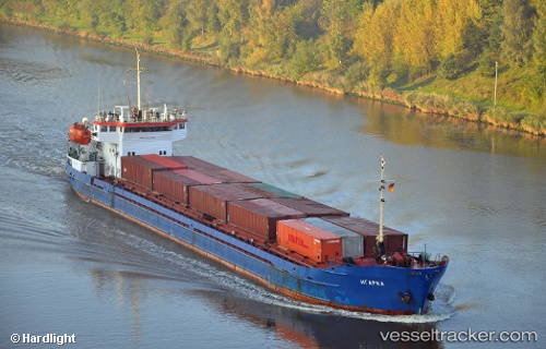
 Igarka
Current Status
Where is the vessel?
Igarka is currently in 15 nm NW of Fier, based on AIS data received less than 1h ago.
Latest AIS update:
Current position: 40.89987° N, 19.31933° E (15 nm NW of Fier)
Average speed (last 7 days): Loading…
Average speed (last 30 days): Loading…
Vessel profile: Igarka is a General Cargo Ship with dimensions 108m x 15m.
This page combines live AIS, route history, probable destination signals, nearby traffic, and port activity for practical vessel monitoring.
The current position of vessel Igarka is 40.89987 lat / 19.31933 lng. Updated: 2026-04-14 13:36:17 UTCNearest reference points:
- 22 nm W of Fier
- Near Durres
- Near Agios Athanasios
Currently sailing under the flag of Russia ![]()
Igarka built in 1986 year
Deadweight:
3174 tDetails:
Live Vessel Igarka Analytics (details, animations, etc.)
Recent AIS points (UTC):
2026-04-14 07:35:13 UTC · 41.30458, 19.45222 · SOG 0 kn · COG 320°2026-04-14 10:08:08 UTC · 41.30459, 19.45223 · SOG 0 kn · COG 321°
2026-04-14 11:47:57 UTC · 41.12835, 19.38690 · SOG 8 kn · COG 194°
2026-04-14 13:36:17 UTC · 40.89987, 19.31933 · SOG 6.7 kn · COG 196°