 vesseltracker.com
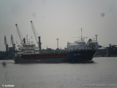
 Hav Pike
Current Status
Where is the vessel?
Hav Pike is currently in 66 nm NW of Saint-Romain-de-Lerps, based on AIS data received about 1h ago.
Latest AIS update:
Current position: 45.68667° N, 6.01667° W (66 nm NW of Saint-Romain-de-Lerps)
Average speed (last 7 days): Loading…
Average speed (last 30 days): Loading…
Vessel profile: Hav Pike is a Multi Purpose Carrier with dimensions 88m x 13m.
This page combines live AIS, route history, probable destination signals, nearby traffic, and port activity for practical vessel monitoring.
The current position of vessel Hav Pike is 45.68667 lat / -6.01667 lng. Updated: 2026-05-15 21:19:23 UTCNearest reference points:
- Near Sennecey-le-Grand
- 57 nm S of Boboras
- 14 nm W of Villy-le-Moutier
Currently sailing under the flag of Antigua Barbuda ![]()
Hav Pike built in 1994 year
Deadweight:
3718 tDetails:
Live Vessel Hav Pike Analytics (details, animations, etc.)
Recent AIS points (UTC):
2026-05-15 17:31:22 UTC · 46.19500, -6.02333 · SOG 7 kn · COG -1°2026-05-15 19:25:21 UTC · 45.94167, -6.01833 · SOG 8 kn · COG -1°
2026-05-15 19:58:21 UTC · 45.86500, -6.02167 · SOG 8 kn · COG -1°
2026-05-15 21:19:23 UTC · 45.68667, -6.01667 · SOG 7 kn · COG -1°