 vesseltracker.com
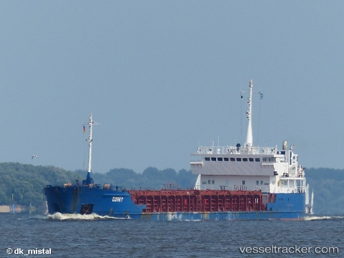
 Gulf
Gulf
Current Status
Where is the vessel?
Gulf is currently in Near Torre Cesarea, based on AIS data received about 1h ago.
Latest AIS update:
Current position: 40.13114° N, 18.59206° E (Near Torre Cesarea)
Average speed (last 7 days): Loading…
Average speed (last 30 days): Loading…
Vessel profile: Gulf is a Multi Purpose Carrier with dimensions 96m x 13m.
This page combines live AIS, route history, probable destination signals, nearby traffic, and port activity for practical vessel monitoring.
The current position of vessel Gulf is 40.13114 lat / 18.59206 lng. Updated: 2026-04-16 20:15:44 UTCNearest reference points:
- 11 nm S of Leuca
- 20 nm S of Leuca
- Near Porto Di Brindisi
Currently sailing under the flag of Antigua Barbuda ![]()
Gulf built in 2000 year
Deadweight:
4325 tDetails:
Live Vessel Gulf Analytics (details, animations, etc.)
Recent AIS points (UTC):
2026-04-16 11:26:21 UTC · 39.35459, 18.02478 · SOG 5.8 kn · COG 36°2026-04-16 13:21:00 UTC · 39.50133, 18.17926 · SOG 5.9 kn · COG 36°
2026-04-16 16:18:24 UTC · 39.74415, 18.43890 · SOG 6.4 kn · COG 39°
2026-04-16 20:15:44 UTC · 40.13114, 18.59206 · SOG 5.7 kn · COG 342°