 vesseltracker.com
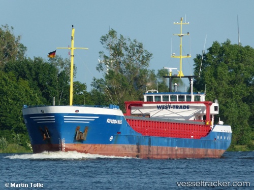
 Rhodanus
Current Status
Where is the vessel?
Rhodanus is currently in Near YUMURTALIC, based on AIS data received about 1h ago.
Latest AIS update:
Current position: 36.77043° N, 35.87190° E (Near YUMURTALIC)
Average speed (last 7 days): Loading…
Average speed (last 30 days): Loading…
Vessel profile: Rhodanus is a General Cargo Ship with dimensions 89m x 12m.
This page combines live AIS, route history, probable destination signals, nearby traffic, and port activity for practical vessel monitoring.
The current position of vessel Rhodanus is 36.77043 lat / 35.87190 lng. Updated: 2026-04-07 10:01:45 UTCNearest reference points:
- Near YUMURTALIC
- Near CEYHAN
- 13 nm W of Iskenderun
Currently sailing under the flag of Antigua Barbuda ![]()
Rhodanus built in 1998 year
Deadweight:
2953 tDetails:
Live Vessel Rhodanus Analytics (details, animations, etc.)
Recent AIS points (UTC):
2026-04-07 03:55:08 UTC · 36.81967, 35.91677 · SOG 0.1 kn · COG 345°2026-04-07 05:40:09 UTC · 36.81955, 35.91677 · SOG 0 kn · COG 347°
2026-04-07 07:31:10 UTC · 36.81968, 35.91615 · SOG 0 kn · COG 10°
2026-04-07 10:01:45 UTC · 36.77043, 35.87190 · SOG 0.1 kn · COG 152°