 vesseltracker.com
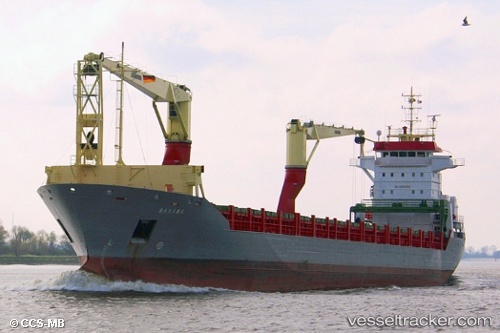
Hc Eva Marie
Current StatusWhere is the vessel?
Hc Eva Marie is currently in 179 nm W of Juazeiro-Pi, based on AIS data received about 1h ago.
Latest AIS update:
Current position: 4.37500° N, 44.56500° W (179 nm W of Juazeiro-Pi)
Average speed (last 7 days): Loading…
Average speed (last 30 days): Loading…
Vessel profile: Hc Eva Marie is a Multi Purpose Carrier with dimensions 18m x 146m.
This page combines live AIS, route history, probable destination signals, nearby traffic, and port activity for practical vessel monitoring.
The current position of vessel Hc Eva Marie is 4.37500 lat / -44.56500 lng. Updated: 2026-04-22 05:36:35 UTCNearest reference points:
- 227 nm W of Juazeiro-Pi
- 223 nm SW of Juazeiro-Pi
Details:
Live Vessel Hc Eva Marie Analytics (details, animations, etc.)
Recent AIS points (UTC):
2026-04-22 01:38:34 UTC · 4.78010, -45.31193 · SOG 12.6 kn · COG 115°2026-04-22 03:37:41 UTC · 4.58270, -44.93927 · SOG 12.6 kn · COG 116°
2026-04-22 04:46:33 UTC · 4.46453, -44.72204 · SOG 12.8 kn · COG 115°
2026-04-22 05:36:35 UTC · 4.37500, -44.56500 · SOG 12 kn · COG -1°