 vesseltracker.com
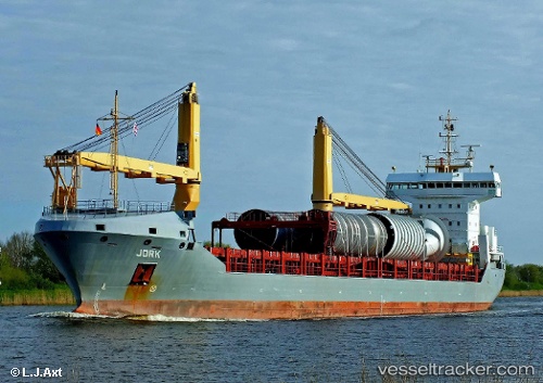
Vessel Jork IMO: 9535606, MMSI: 305656000 General Cargo Ship
UTC, 29.94360, -89.99756, course: 354, speed: 0
UTC, 29.94333, -89.99667, course: -1, speed: 0
2026-01-31 16:12:36 UTC, 29.94333, -89.99667, course: -1, speed: 0
Live AIS position:
UTC. Near Terrytown),
updated 2026-01-31 16:12:36 UTC.
Find the position of the vessel Jork on the map. The latter are known coordinates and path.
marine traffic ship tracker show on live map
The current position of vessel Jork is 29.94333 lat / -89.99667 lng. Updated: 2026-01-31 16:12:36 UTCDetails:
Last coordinates of the vessel:
UTC, 29.94361, -89.99755, course: 354, speed: 0UTC, 29.94360, -89.99756, course: 354, speed: 0
UTC, 29.94333, -89.99667, course: -1, speed: 0
2026-01-31 16:12:36 UTC, 29.94333, -89.99667, course: -1, speed: 0