 vesseltracker.com
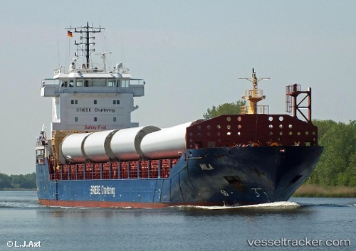
 Mila
Mila
Current Status
Where is the vessel?
Mila is currently in Near San Juan de Nieva, based on AIS data received about 1d ago.
Latest AIS update:
Current position: 43.56115° N, 5.91739° W (Near San Juan de Nieva)
Average speed (last 7 days): Loading…
Average speed (last 30 days): Loading…
Vessel profile: Mila is a Multi Purpose Carrier with dimensions 129m x 16m.
This page combines live AIS, route history, probable destination signals, nearby traffic, and port activity for practical vessel monitoring.
The current position of vessel Mila is 43.56115 lat / -5.91739 lng. Updated: 2026-04-10 08:05:49 UTCNearest reference points:
- Near San Juan de Nieva
- Near Musel-Arnao
- Near Tremanes
Currently sailing under the flag of Antigua Barbuda ![]()
Mila built in 2013 year
Deadweight:
8227 tDetails:
Live Vessel Mila Analytics (details, animations, etc.)
Recent AIS points (UTC):
2026-04-10 02:35:50 UTC · 43.56115, -5.91738 · SOG 0 kn · COG 165°2026-04-10 04:20:50 UTC · 43.56114, -5.91737 · SOG 0 kn · COG 165°
2026-04-10 05:20:50 UTC · 43.56114, -5.91739 · SOG 0 kn · COG 165°
2026-04-10 08:05:49 UTC · 43.56115, -5.91739 · SOG 0 kn · COG 165°