 vesseltracker.com
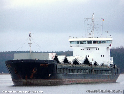
Vessel Karewood Star IMO: 9363986, MMSI: 311000648 General Cargo Ship
UTC, 57.80644, 22.49088, course: 70, speed: 6.8
UTC, 57.80644, 22.49088, course: 70, speed: 6.8
2026-01-15 03:45:54 UTC, 57.80644, 22.49088, course: 70, speed: 6.8
Live AIS position:
UTC. 14 nm SE of Kaavi Paadisadam),
updated 2026-01-15 03:45:54 UTC.
Find the position of the vessel Karewood Star on the map. The latter are known coordinates and path.
marine traffic ship tracker show on live map
The current position of vessel Karewood Star is 57.80644 lat / 22.49088 lng. Updated: 2026-01-15 03:45:54 UTCCurrently sailing under the flag of Bahamas
Karewood Star built in 2007 year
Deadweight:
6355 tDetails:
Last coordinates of the vessel:
UTC, 57.80644, 22.49088, course: 70, speed: 6.8UTC, 57.80644, 22.49088, course: 70, speed: 6.8
UTC, 57.80644, 22.49088, course: 70, speed: 6.8
2026-01-15 03:45:54 UTC, 57.80644, 22.49088, course: 70, speed: 6.8