 vesseltracker.com
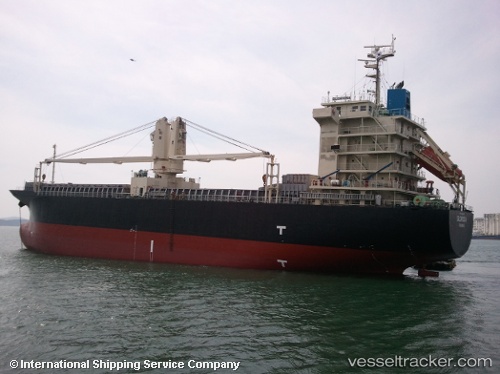
Vessel BERKAY N IMO: 9524827, MMSI: 314496000 General Cargo Ship
UTC, 51.09707, 3.75037, course: 154, speed: 0
UTC, 51.09702, 3.75032, course: 154, speed: 0
2026-03-24 21:53:13 UTC, 51.09700, 3.75035, course: -1, speed: 0
Live Vessel BERKAY N Analytics (details, animations, etc.)
Live AIS position: UTC. Near Oostakker), updated 2026-03-24 21:53:13 UTC.Find the position of the vessel BERKAY N on the map. The latter are known coordinates and path.
marine traffic ship tracker show on live map
The current position of vessel BERKAY N is 51.09700 lat / 3.75035 lng. Updated: 2026-03-24 21:53:13 UTCCurrently sailing under the flag of Barbados
BERKAY N built in 2008 year
Deadweight:
12046 tDetails:
Last coordinates of the vessel:
UTC, 51.09704, 3.75037, course: 154, speed: 0UTC, 51.09707, 3.75037, course: 154, speed: 0
UTC, 51.09702, 3.75032, course: 154, speed: 0
2026-03-24 21:53:13 UTC, 51.09700, 3.75035, course: -1, speed: 0