 vesseltracker.com
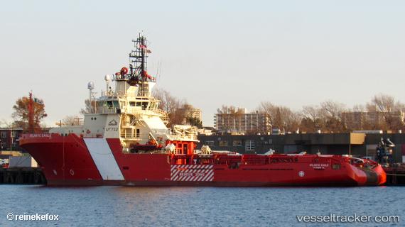
 Ccgs Atlantic Eagle
Current Status
Where is the vessel?
Ccgs Atlantic Eagle is currently in Near Coal Harbour, based on AIS data received about 2h ago.
Latest AIS update:
Current position: 50.50670° N, 127.71800° W (Near Coal Harbour)
Average speed (last 7 days): Loading…
Average speed (last 30 days): Loading…
Vessel profile: Ccgs Atlantic Eagle is a Offshore Tug Supply Ship with dimensions 75m x 18m.
This page combines live AIS, route history, probable destination signals, nearby traffic, and port activity for practical vessel monitoring.
The current position of vessel Ccgs Atlantic Eagle is 50.50670 lat / -127.71800 lng. Updated: 2026-04-26 07:38:10 UTCNearest reference points:
- Near PORT HARDY
- 29 nm NW of Coal Harbour
- 63 nm N of PORT HARDY
Currently sailing under the flag of Canada ![]()
Details:
Live Vessel Ccgs Atlantic Eagle Analytics (details, animations, etc.)
Recent AIS points (UTC):
2026-04-26 04:09:54 UTC · 50.50500, -127.71800 · SOG 0 kn · COG 90°2026-04-26 05:58:40 UTC · 50.50670, -127.71800 · SOG 0 kn · COG 90°
2026-04-26 07:15:54 UTC · 50.50670, -127.71800 · SOG 0 kn · COG 256°
2026-04-26 07:38:10 UTC · 50.50670, -127.71800 · SOG 0 kn · COG 256°