 vesseltracker.com
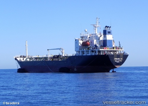
 RED SEA 1
Current Status
Where is the vessel?
RED SEA 1 is currently in Near Djibouti, based on AIS data received about 448d ago.
Latest AIS update:
Current position: 11.60945° N, 43.13215° E (Near Djibouti)
Average speed (last 7 days): Loading…
Average speed (last 30 days): Loading…
Vessel profile: RED SEA 1 is a Oil Products Tanker with dimensions 18m x 115m.
This page combines live AIS, route history, probable destination signals, nearby traffic, and port activity for practical vessel monitoring.
The current position of vessel RED SEA 1 is 11.60945 lat / 43.13215 lng. Updated: 2025-02-20 13:43:17 UTCNearest reference points:
- Near Djibouti
Currently sailing under the flag of St.Kitts and Nevis ![]()
RED SEA 1 built in 1994 year
Deadweight:
9593 tDetails:
Live Vessel RED SEA 1 Analytics (details, animations, etc.)
Recent AIS points (UTC):
2025-02-20 13:43:17 UTC · 11.60945, 43.13215 · SOG 0 kn · COG 220°