 vesseltracker.com
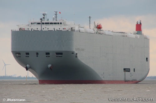
 California Highway
Current Status
Where is the vessel?
California Highway is currently in 18 nm N of Auderville, based on AIS data received about 16h ago.
Latest AIS update:
Current position: 50.01579° N, 1.84178° W (18 nm N of Auderville)
Average speed (last 7 days): Loading…
Average speed (last 30 days): Loading…
Vessel profile: California Highway is a Vehicles Carrier with dimensions 200m x 32m.
This page combines live AIS, route history, probable destination signals, nearby traffic, and port activity for practical vessel monitoring.
The current position of vessel California Highway is 50.01579 lat / -1.84178 lng. Updated: 2026-04-10 08:07:57 UTCNearest reference points:
- Near Équeurdreville
- 22 nm S of Holbury
- Near Cherbourg
Currently sailing under the flag of Panama ![]()
California Highway built in 2010 year
Deadweight:
18644 tDetails:
Live Vessel California Highway Analytics (details, animations, etc.)
Recent AIS points (UTC):
2026-04-10 02:38:02 UTC · 49.75547, -3.92057 · SOG 15.6 kn · COG 84°2026-04-10 04:22:17 UTC · 49.79464, -3.23245 · SOG 15.3 kn · COG 84°
2026-04-10 05:22:27 UTC · 49.84569, -2.84980 · SOG 14.9 kn · COG 75°
2026-04-10 08:07:57 UTC · 50.01579, -1.84178 · SOG 14.8 kn · COG 77°