 vesseltracker.com
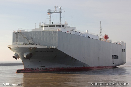
 Malacca Highway
Current Status
Where is the vessel?
Malacca Highway is currently in Near Sheerness, based on AIS data received less than 1h ago.
Latest AIS update:
Current position: 51.43667° N, 0.73833° E (Near Sheerness)
Average speed (last 7 days): Loading…
Average speed (last 30 days): Loading…
Vessel profile: Malacca Highway is a Vehicles Carrier with dimensions 139m x 23m.
This page combines live AIS, route history, probable destination signals, nearby traffic, and port activity for practical vessel monitoring.
The current position of vessel Malacca Highway is 51.43667 lat / 0.73833 lng. Updated: 2026-04-19 14:00:04 UTCNearest reference points:
- Near GILLINGHAM
- Near BURNHAM ON CROUCH
- Near HEYBRIDGE
Currently sailing under the flag of Panama ![]()
Malacca Highway built in 2001 year
Deadweight:
6864 tDetails:
Live Vessel Malacca Highway Analytics (details, animations, etc.)
Recent AIS points (UTC):
2026-04-19 10:15:08 UTC · 51.44453, 0.73815 · SOG 4.2 kn · COG 202°2026-04-19 12:24:02 UTC · 51.43667, 0.73833 · SOG 0 kn · COG -1°
2026-04-19 13:59:26 UTC · 51.43828, 0.73960 · SOG 0 kn · COG 26°
2026-04-19 14:00:04 UTC · 51.43667, 0.73833 · SOG 0 kn · COG -1°