 vesseltracker.com
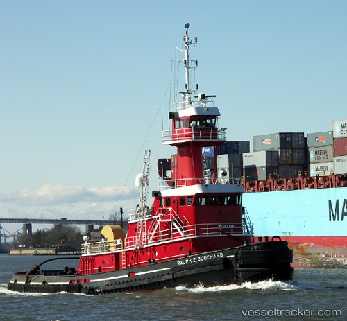
Ralph E Bouchard
Current StatusWhere is the vessel?
Ralph E Bouchard is currently in Near Tottenville, Staten Island, based on AIS data received less than 1h ago.
Latest AIS update:
Current position: 40.54524° N, 74.24694° W (Near Tottenville, Staten Island)
Average speed (last 7 days): Loading…
Average speed (last 30 days): Loading…
Vessel profile: Ralph E Bouchard is a Pusher Tug with dimensions 24m x 175m.
This page combines live AIS, route history, probable destination signals, nearby traffic, and port activity for practical vessel monitoring.
The current position of vessel Ralph E Bouchard is 40.54524 lat / -74.24694 lng. Updated: 2026-04-26 03:26:49 UTCNearest reference points:
- Near South Amboy
- Near Bayway
- Near Elizabethport
Details:
Live Vessel Ralph E Bouchard Analytics (details, animations, etc.)
Recent AIS points (UTC):
2026-04-25 23:36:00 UTC · 40.54536, -74.24698 · SOG 0 kn · COG 55°2026-04-26 01:11:00 UTC · 40.54523, -74.24697 · SOG 0 kn · COG 54°
2026-04-26 01:25:20 UTC · 40.54521, -74.24694 · SOG 0 kn · COG 54°
2026-04-26 03:26:49 UTC · 40.54524, -74.24694 · SOG 0 kn · COG 54°