 vesseltracker.com
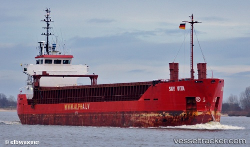
 SKY VISA
Current Status
Where is the vessel?
SKY VISA is currently in Near Burgas, based on AIS data received less than 1h ago.
Latest AIS update:
Current position: 42.48648° N, 27.45446° E (Near Burgas)
Average speed (last 7 days): Loading…
Average speed (last 30 days): Loading…
Vessel profile: SKY VISA is a General Cargo Ship with dimensions 13m x 88m.
This page combines live AIS, route history, probable destination signals, nearby traffic, and port activity for practical vessel monitoring.
The current position of vessel SKY VISA is 42.48648 lat / 27.45446 lng. Updated: 2026-04-04 19:25:45 UTCNearest reference points:
- Near Beloslav
- Near Ignatievo
- Near Varna
Currently sailing under the flag of Panama ![]()
SKY VISA built in 1991 year
Deadweight:
4195 tDetails:
Live Vessel SKY VISA Analytics (details, animations, etc.)
Recent AIS points (UTC):
2026-04-04 14:19:54 UTC · 42.48648, 27.45448 · SOG 0 kn · COG 39°2026-04-04 16:13:25 UTC · 42.48647, 27.45448 · SOG 0 kn · COG 39°
2026-04-04 18:13:56 UTC · 42.48646, 27.45449 · SOG 0 kn · COG 38°
2026-04-04 19:25:45 UTC · 42.48648, 27.45446 · SOG 0 kn · COG 39°